The village Gyumgyum (now Vardo) was the administrative seat of the kaza Vardo (Western Armenian: Varto), located on the right side of the Aradzan (Trk.: Murat) River, in the forested valley of the Bazkan, or Byurakn (meaning ‘one thousand springs’, Trk.: Bingöl; in the lower stream: Charbuhar) river and at the southern slope of the Byurakn mountains, in the northwestern part of the Bitlis province. The county is rich in cold springs, mineral waters (Lalazar Jermuks are known), and flowery, grassy meadows. The climate is cool and healthy. According to Armenian legend, the biblical paradise was located here.
Administration
Until the middle of the 19th century Vardo was divided into two parts. The northern part, which was also called Bazkan (Bingöl) after its center, was subordinated to the beys of Khnus district of the Erzurum Paşalık, while the southern part, or Charbuhar county was included in the Mush district. From the second half of the 19th century Vardo was part of Erzurum, then of the Mush sancak of Bitlis province.
Toponym
The county was named after the village of Varduk (its ruins are located north of St. Karapet Monastery in the Mush plain). Other explanations trace the toponym back to the pre-Christian goddess Astghik, revered in southern Armenia, on whose feast day Vardavar (‘The Fest of Rose-Burning’) roses (Armenian: vard) were offered, or to the legendary Armenian warlord Vardan Mamikonian, who acquired Vardo as his summer residence.

Population
Most Armenian villages were situated in the flood plain of the Bazkan (Bingöl) River, known as Charbuhar or Vardo (present-day Kaynarca Deresi) in its lower course, in the Gundemir nahiye, the center of which was inhabited by Armenians alone. At the end of the 19th century, Gundemir village, the administrative seat of the nahiye of same name, had a population of 200 houses. 60 Armenian houses lived in the village of Gyumgyum, the administrative seat of the kaza Vardo.
The French geographer Vital Cuinet suggested in 1891, that the county had a population of 16,994, of which 9,000 were Muslims and 7,994 were Armenians. Since the late 1870s, the Muslim population consisted of Kurds and Circassian muhacirler. According to the survey of the Armenian Patriarchate of Constantinople, there lived 4,649 Armenian in nine localities before the First World War, maintaining seven churches, three monasteries[1], and four parish schools for 210 students.[2]
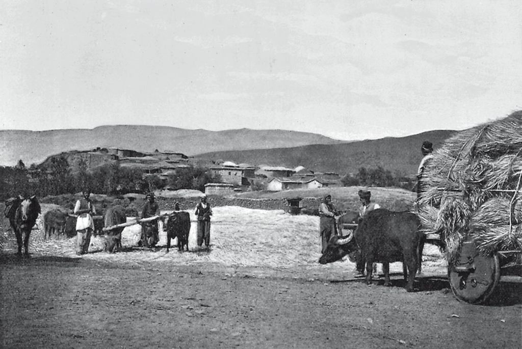
The population mainly engaged in grain, vegetable crops, tobacco, horticulture, animal husbandry and beekeeping.
Today, Vardo is a town of 17,000 inhabitants, many of them Islamized and Kurdified or Turkified crypto-Armenians.
History
The county Vardo corresponds to the eastern part of the Ashamunik canton of the ancient Armenian Turuberan province. In 1071, with the Seljuk invasion and the Battle of Manazkert, Vardo came under Seljuk rule, and in 1514, under Ottoman rule. It passed to the Ottoman Empire in 1555 under the Ottoman-Iranian Treaty of Amasia.
Under Ottoman rule, the formerly almost exclusively Armenian region became ethnically and religiously diversified. In the 17th century, Zaza-speaking Kizilbaş nomads called Dmlik (Demlik; Dimili?), from the Hormek (Khoramaktsi) tribe penetrated the northwestern parts of the county. In the 18th century, Kurds challenged the Armenian homogeneity in Vardo. Initially Kurds entered the county only in the summer months to graze their sheep, but later began settling in Armenian villages. In the winter months, Armenians were forced to abide by an Ottoman requirement called kışlak (winter quarters), that is, to provide pastures to Kurdish flocks. This practice stimulated influx of Kurds especially into the fertile lands around the Byurakn Mountains. Consequently, by the mid-nineteenth century, a number of Armenian villages were abandoned.[3]
Destruction
Most Armenians of the kaza died during the 1915 genocide. A small number took refuge in Eastern Armenia.
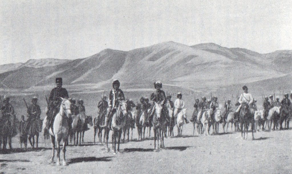
“No fewer than six days, from 9 to 14 July, were required to extirpate the Armenians from the plain of Mush and the northwestern kaza of Varto (nine villages with a total Armenian population of 649). Roughly 20,000 people managed to flee to the Sasun highland, near Havadorig, where they crowded into an area with a circumference of three to three-and-a.half miles, a veritable trap in which they found themselves surrounded, along with the rest of the Sasun mountain district.”
Raymond Kévorkian: The Armenian Genocide: A Complete History. London, New York: I.B. Tauris, 2011, p. 348